| Subject: | Re: [OM] storm |
|---|---|
| From: | Mike Lazzari <watershed@xxxxxxxxxxxxxxx> |
| Date: | Sun, 10 Feb 2013 09:38:38 -0800 |
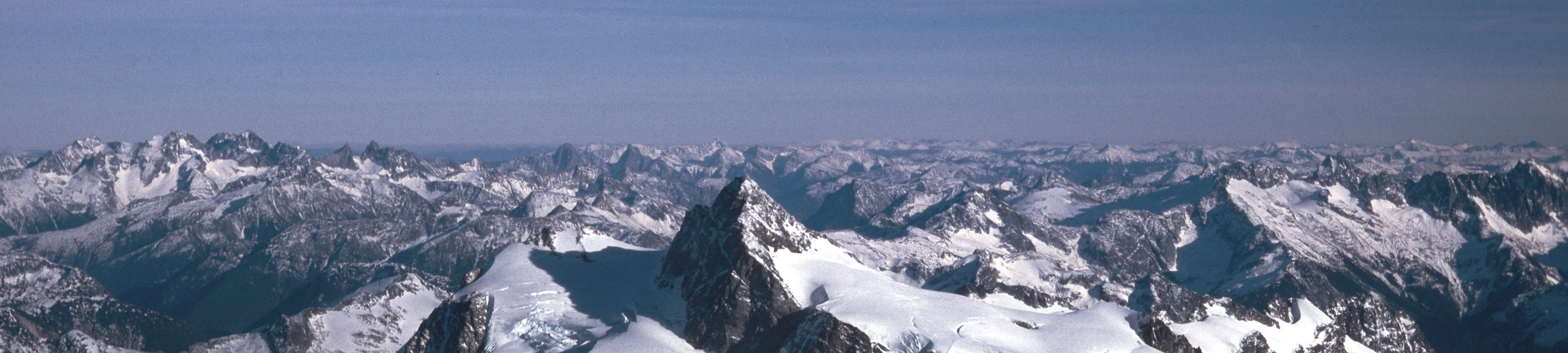
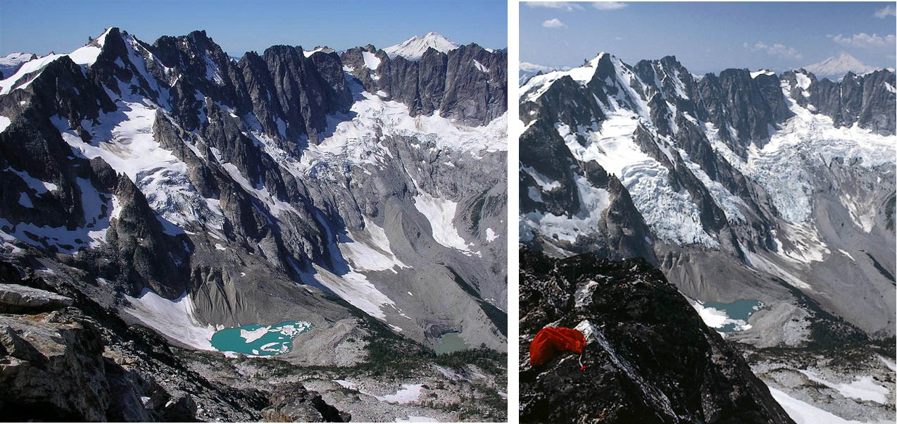
Moose, Your photo, "N. Cascades", is of what we WA's call the S. Cascades it being down near Mt Rainier. I don't mean to quibble as obviously the WA Cascades anchor the north end of the range but the distinction is important locally. The NC might arbitrarily begin at the Hwy 2 crossing and north to and a little beyond the border. Precip is comparable to the Olympics, highest in the Lower 48. there is much more "permanent" snow than all the rest of the Lower 48 combined. However it is rapidly retreating and some glaciers I saw as a kid are no longer there at all! The models show that more of the precip will fall as rain and at a higher altitude. This is a serious problem for those who depend on water stored as snow for summer irrigation. From an old slide which I may have previously posted. <http://www.interisland.net/watershed/mike/aerialShu-pan.jpg> And here is a before and after. Rather after/before. First taken in the '00's, the latter 30 yrs earlier. <http://www.interisland.net/watershed/mike/Luna%20compared.jpg> Mike -- _________________________________________________________________ Options: http://lists.thomasclausen.net/mailman/listinfo/olympus Archives: http://lists.thomasclausen.net/mailman/private/olympus/ Themed Olympus Photo Exhibition: http://www.tope.nl/ |
| <Prev in Thread] | Current Thread | [Next in Thread> |
|---|---|---|
| ||
| Previous by Date: | Re: [OM] How about a BW conversion of an E1 file, Jim Nichols |
|---|---|
| Next by Date: | Re: [OM] How about a BW conversion of an E1 file, Paul Braun |
| Previous by Thread: | Re: [OM] storm, Chuck Norcutt |
| Next by Thread: | Re: [OM] storm, Chris Trask |
| Indexes: | [Date] [Thread] [Top] [All Lists] |